| GER - GERMANY | ||||||||||||||||
| LIEDOLSHEIM | ||||||||||||||||
| SORRY, SOME DATA ARE NOT TRANSLATED YET | ||||||||||||||||
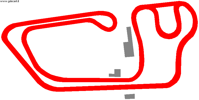
| Description | The only info I have on this kart track is that on May 11th 1986 it hosted Formula K European Championship. I have no more info. | |||||||||||||||
| Location |
Dettenheim BW - Baden-Württemberg - 1949÷1990: BRD Between Dettenheim and Linkenheim, a little less then 20 km - 11 mi North of Karlsruhe |
|||||||||||||||
| Latitude - Longitude |
+ 49°08'36" + 8°25'49" 49.143333 8.430278 |
|||||||||||||||
| UTM Coordinates | X = 458448.897 - Y = 5443545.88 - Zone 32U | |||||||||||||||
| Aerial photo / Map (*) |
 OpenStreetMap - Google Maps - Bing Maps - Zoom Earth - Wikimapia |
|||||||||||||||
| Altitude AMSL | 108 m - 354 ft | |||||||||||||||
| Inauguration | ||||||||||||||||
| Closing | ||||||||||||||||
| Designer | ||||||||||||||||
| Sources and links (Translation) (**) |
|
|||||||||||||||
| Liedolsheim | |||||
| Description | length 1060 m is referred to the longer track layout | ||||
| Years | |||||
| Direction |
 Clockwise |
||||
 Proposal |
NO | ||||
| No longer operational | |||||
| Car Circuit | |||||
| Motorbike circuit | |||||
| Type | Kart track | ||||
| Inauguration | |||||
| Closing | |||||
| Last update of this page | December 3rd 2007 | ||||
| Info last update | |||||
| Designer | |||||
| Distinctive points | |||||
| length | 1060 m | 3478 ft | 0.659 mi | Long circuit | (2) |
| Width | 7 m | 23 ft | (2) | ||
Liedolsheim
| Updates | |||||||
| Date | Track layout | Years | Description by | Map by | Thanks to | Note | |
| December 3rd 2007 | Guido de Carli | Martin Berrang | Update | Description | |||
| October 16th 2005 | Guido de Carli | Guido de Carli | New | Description with map | |||
| Not all eventual updates issued in last years are already visible in this list | |||||||


