| USA - UNITED STATES | |||||||||||||
| CORONA GRAND BOULEVARD | |||||||||||||
| Description | The track was on Grand Boulevard at Corona, a town planed in 1896 included into this perfect circle. After great succes of Santa Monica races, even Corona decided to host a race. First one was on September 9th 1913, second one on Thanksgiving Day in 1914 and the last one on April 8th 1916. In this final event, a fatal crash occurred: Bob Bruman’s Peugeot went off and killed a his riding mechanic and a policemen. This accident cause the end of races here. | ||||||||||||
| Location | Corona CA - California - Western States | ||||||||||||
| Location | |||||||||||||
| Latitude - Longitude | + 33°52'32" -117°33'58" 33.875556 -117.566111 | ||||||||||||
| UTM Coordinates | X = 447644.439 - Y = 3748502.185 - Zone 11S | ||||||||||||
| Aerial photo / Map (*) |  OpenStreetMap - Google Maps - Bing Maps - Flash Earth - Wikimapia - Microsoft Research Maps - MapQuest OpenStreetMap - Google Maps - Bing Maps - Flash Earth - Wikimapia - Microsoft Research Maps - MapQuest | ||||||||||||
| Altitude AMSL | 205 m - 673 ft | ||||||||||||
| Inauguration | September 13th 1913 | ||||||||||||
| Closing | April 8th 1916 | ||||||||||||
| Designer | |||||||||||||
| Sources and links (Translation) (**) |
| ||||||||||||
| Corona Grand Boulevard | |||||
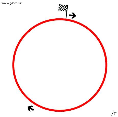
| Description | According to Motor Racing Circuits Database direction was clockwise. Mister NN wrote me that photos show that direction was anticlockwise as usual, but he didn’t sent me any reference to any source. I have no time to do some research about this matter | ||||
| Years | |||||
| Direction |  Anticlockwise Anticlockwise | ||||
 Proposal Proposal |
NO | ||||
| No longer operational | YES | ||||
| Car Circuit | YES | ||||
| Motorbike circuit | |||||
| Type | Oval course | ||||
| Inauguration | September 13th 1913 | ||||
| Closing | April 8th 1916 | ||||
| Last update of this page | October 21st 2013 | ||||
| Info last update | |||||
| Designer | |||||
| Distinctive points | |||||
| length | 4448 m | 14594 ft | 2.764 mi | (3) | |
| length | 4455 m | 14615 ft | 2.768 mi | (2) | |
| Diameter | 1416 m | 4646 ft | 0.88 mi | (3) | |
Corona Grand Boulevard (direction is wrong - see description)
Due to technical problems, temporarily it’s no longer possible to see the circuits on Google Maps embedded in the current page.
This feature will be restored as soon as I figure out how to do (any help would be appreciated!)
See this track layout with Google Earth
(milermeter.com can be used in your browser, without installing anything; Google Earth is a program that must be installed in your computer)
(Map shown here above can show at the same time all eventual layouts drawn. If you want to see only some of them, please go to Google Maps or Google Earth, by clicking on its own link)
| Updates | |||||||
| Date | Track layout | Years | Description by | Map by | Thanks to | Note | |
| October 21st 2013 | Guido de Carli | NN | Update | Description | |||
| May 19th 2007 | Guido de Carli | Lorenzo Tommasi | Update | Description with map | |||
| May 15th 2007 | Guido de Carli | Lorenzo Tommasi | Update | Description with map | |||
| November 23rd 2004 | Guido de Carli | New | Description | ||||
| Not all eventual updates issued in last years are already visible in this list | |||||||


