| GRE - GREECE | |||||||||
| MARITSA / ΜΑΡΊΤΣΑ | |||||||||
| Description | |||||||||
| Location | Rodi / Rhodes / Rodos - Dodecaneso / Dodecanese - Egeo Meridionale / South Aegean | ||||||||
| Location | On Rhodes airport runways | ||||||||
| Latitude - Longitude | + 36°23'02" + 28°06'49" 36.383889 28.113611 | ||||||||
| UTM Coordinates | X = 599880.303 - Y = 4027104.544 - Zone 35S | ||||||||
| Aerial photo / Map (*) |  OpenStreetMap - Google Maps - Bing Maps - Flash Earth - Wikimapia OpenStreetMap - Google Maps - Bing Maps - Flash Earth - Wikimapia | ||||||||
| Altitude AMSL | 45 m - 148 ft | ||||||||
| Inauguration | |||||||||
| Closing | |||||||||
| Designer | |||||||||
| Sources and links (Translation) (**) |
| ||||||||
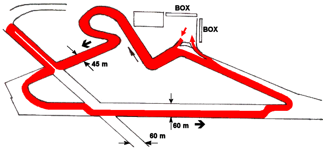
| Maritsa / Μαρίτσα | |||||
| Description | |||||
| Years | 1978 | ||||
| Direction |  Anticlockwise Anticlockwise | ||||
 Proposal Proposal |
YES
| ||||
| Proposal not developed | YES | ||||
| Car Circuit | YES | ||||
| Motorbike circuit | |||||
| Type | Airfield course | ||||
| Inauguration | |||||
| Closing | |||||
| Last update of this page | April 30th 2006 | ||||
| Info last update | December 1978 | ||||
| Designer | |||||
| Distinctive points | |||||
| length (approx) | 4400 m | 14436 ft | 2.734 mi | Approximated length | (2) |
Maritsa
| Updates | |||||||
| Date | Track layout | Years | Description by | Map by | Thanks to | Note | |
| June 18th 2007 | Guido de Carli | Update | Description | ||||
| Not all eventual updates issued in last years are already visible in this list | |||||||


