| ITA - ITALY | |||||||||||||||||||||||||||||||||
| PUTIGNANO | |||||||||||||||||||||||||||||||||
| SORRY, SOME DATA ARE NOT TRANSLATED YET | |||||||||||||||||||||||||||||||||
| Description | This was a proposal made by A.C. (Automobile Club) Bari on December 1965 for a permanent circuit in Puglia. Proposal was approved and on April 1st 1967 its construction begun. In 1969 70% of the track and 30% of facilities were built and within one year the first race could have been held. Unfortunately Putignano Comune (circuit’s owner) had an economical and political crisis and in 1970 all works, still unfinished, were stopped because of lack of money. Since then, several trials were carried out, but it wasn’t possible to finish track construction. Two sources reports two different maps, probably with reference to two different steps of the proposal, but I have no more indo. Now it’s still possible to see what is was built from aerial photos. | ||||||||||||||||||||||||||||||||
| Location | Putignano BA - Bari - Puglia | ||||||||||||||||||||||||||||||||
| Location | Eastern suburb of Putignano | ||||||||||||||||||||||||||||||||
| Latitude - Longitude | + 40°50'49" + 17°08'15" 40.846944 17.1375 | ||||||||||||||||||||||||||||||||
| UTM Coordinates | X = 680188.35 - Y = 4523965.461 - Zone 33T | ||||||||||||||||||||||||||||||||
| Aerial photo / Map (*) |  OpenStreetMap - Google Maps - Bing Maps - Flash Earth - Wikimapia OpenStreetMap - Google Maps - Bing Maps - Flash Earth - Wikimapia | ||||||||||||||||||||||||||||||||
| Altitude AMSL | 355 m - 1165 ft | ||||||||||||||||||||||||||||||||
| Inauguration | |||||||||||||||||||||||||||||||||
| Closing | |||||||||||||||||||||||||||||||||
| Designer | |||||||||||||||||||||||||||||||||
| Sources and links (Translation) (**) |
| ||||||||||||||||||||||||||||||||
| Putignano | |||||
| Description | |||||
| Years | 1965 | ||||
| Direction |  Anticlockwise Anticlockwise | ||||
 Proposal Proposal |
YES
| ||||
| Proposal not developed | YES | ||||
| Car Circuit | |||||
| Motorbike circuit | |||||
| Type | |||||
| Inauguration | |||||
| Closing | |||||
| Last update of this page | April 4th 2006 | ||||
| Info last update | |||||
| Designer | |||||
| Distinctive points | |||||
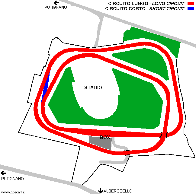
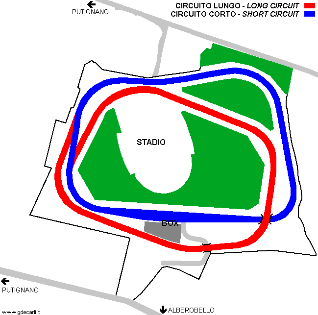
| length | 2500 m | 8202 ft | 1.553 mi | ||
| Putignano | |||||
| Description | |||||
| Years | 1967 | ||||
| Direction | |||||
| Proposal |
YES
| ||||
| Proposal not developed | YES | ||||
| Car Circuit | YES | ||||
| Motorbike circuit | |||||
| Type | Permanent | ||||
| Inauguration | |||||
| Closing | |||||
| Last update of this page | May 18th 2008 | ||||
| Info last update | November 1967 | ||||
| Designer | |||||
| Distinctive points | |||||
| length | 2340 m | 7677 ft | 1.454 mi | (2) | |
| length | 2340 m | 7677 ft | 1.454 mi | Long circuit | (3) |
| length | 1220 m | 4003 ft | 0.758 mi | Short circuit | (3) |
| length | 1325 m | 4347 ft | 0.823 mi | Sum of all straights | (3) |
| length | 1015 m | 3330 ft | 0.631 mi | Sum of all corners | (3) |
| Width | 10 m | 33 ft | (2) | ||
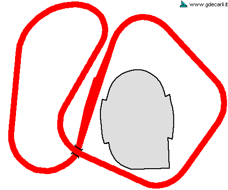
Putignano: original 1967 proposal
| Updates | |||||||
| Date | Track layout | Years | Description by | Map by | Thanks to | Note | |
| May 18th 2008 | Guido de Carli | Update | Description | ||||
| August 18th 2005 | Guido de Carli | Update | Description | ||||
| April 5th 2005 | Guido de Carli | Guido de Carli | Update | Description with map | |||
| October 29th 2003 | Guido de Carli | Guido de Carli | New | Description with map | |||
| Not all eventual updates issued in last years are already visible in this list | |||||||


