| (1) |
 |
members.fortunecity.com/quintin_cloud/19501965/195065nc/1952mod.htm | 1952 Modena GP |
| (2) |
 |
members.fortunecity.com/quintin_cloud/19501965/195065nc/1953mod.htm | 1953 Modena GP |
| (3) |
|
sit.comune.modena.it/Turistica | Modena Map |
| (4) |
|
www.modelfoxbrianza.it/diorama_Aerautodromo_di_Modena.htm | Diorama dell’Aerautodromo - ModelfoxBrianza.it |
| (5) |
|
www.modenaterradimotori.com | Modena Terra di Motori - info about the circuit are not anymore available |
| (6) |
|
www.the-fastlane.co.uk/formula2/F252_39.htm | 1953 Modena GP |
| (7) |
|
www.the-fastlane.co.uk/formula2/F252_39.htm | 1952 Modena GP |
| (8) |
|
Autosprint 20/1965 (page 62) | Circuito chiuso... per ferie! |
| (9) |
|
Autosprint 6/1966 (page 39) | Modenesi alla riscossa (con mappa) |
| (10) |
|
Autosprint 2/1967 (page 2) | Salvo l’Aerautodromo? |
| (11) |
|
Autosprint 4/1967 (page 4) | Present situation and history of the circuit |
| (12) |
|
Autosprint 4/1967 (page 1) | Foto inizio lavori del 1949 e situazione attuale |
| (13) |
|
Autosprint 29/1967 (page 3) | Sarà riaperto nel 1968, modificato ed allungato |
| (14) |
|
Autosprint 42/1967 (page 19) | L’autodromo non si riaprirà? |
| (15) |
|
Autosprint 49/1967 (page 29) | Articolo sugli autodromo italiani in genere e mappa |
| (16) |
|
Autosprint 8/1968 (page 25) | Perché è inagibile? |
| (17) |
|
Autosprint 11/1968 (page 3) | Circuito inagibile.... per mancanza di gabinetti pubblici! |
| (18) |
|
Autosprint 13/1968 (page 24) | Taruffi dice che il circuito è sicuro e ha suggerito come migliorarlo |
| (19) |
|
Autosprint 17/1968 (page 20) | Necessari 20 milioni per salvare l’autodromo |
| (20) |
|
Autosprint 27/1968 (page 26) | Il circuito riaprirà in settembre |
| (21) |
|
Autosprint 8/1969 (page 24) | Spesi 12 milioni per la sicurezza in vista delle gare del 23 marzo |
| (22) |
|
Autosprint 16/1969 (page 23) | Sarà chiuso sia ad auto che a moto? |
| (23) |
|
Autosprint 47/1969 (page 39) | Il terreno sarà usato per la fiera, circuito e aeroporto saranno spostati |
| (24) |
|
Autosprint 22/1971 (page 21) | (senza mappa) |
| (25) |
|
Autosprint 25/1971 (page 12) | Aggiornamento situazione (senza mappa) |
| (26) |
|
Autosprint 32/1971 (page 31) | Attività consentita solodalle 9 alle 12 e dalle 15.30 alle 19 |
| (27) |
|
Autosprint 31/1972 (page 7) | Va all’asta l’Aeroautodromo |
| (28) |
|
Autosprint 41/1972 (page 34) | Aggiornamento situazione (senza mappa) |
| (29) |
|
Autosprint 42/1972 (page 34) | Bocciata la proposta per riaprire l’autodromo |
| (30) |
|
Autosprint 46/1972 (page 8) | Tramontate le ultime speranze di riapertura |
| (31) |
|
Autosprint 40/1973 (page 47) | Prima gara (rallycross) dopo 12 anni di soli test |
| (32) |
|
Autosprint 51/1977 (page 43) | Test per una restaurata Maserati 1100 4 CS del 1934 |
 OpenStreetMap -
  Anticlockwise
 Proposal
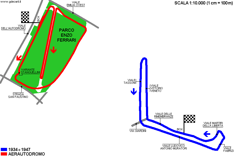 1933÷1947 circuit" />
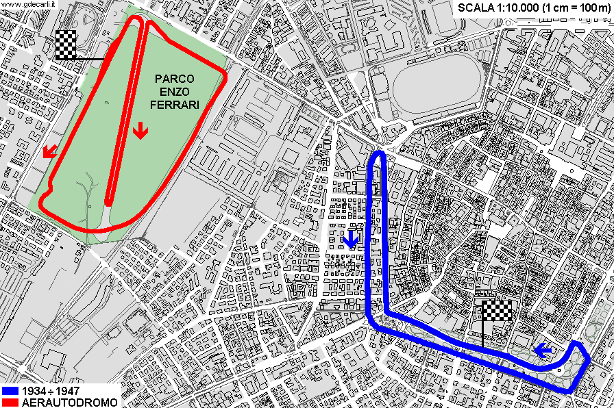 1933÷1947 circuit" />
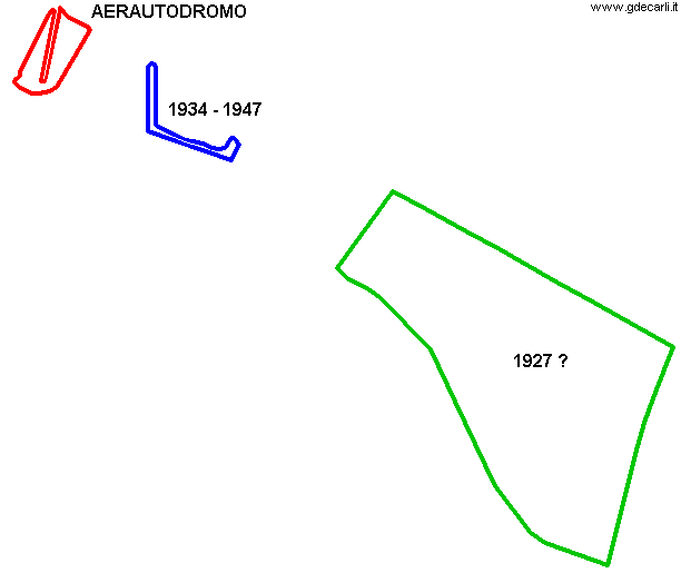 1933÷1947 circuit" />

