 Visualizza questa pagina in Italiano
 HOME PAGE
|
Visualizza questa pagina in Italiano
|
HOME PAGE
|
Legend and translations |
| ITA - ITALY | |||||
| CALCARELLI | |||||
| SORRY, SOME DATA ARE NOT TRANSLATED YET | |||||
| Description | Permanent circuit proposed by Baron Antonio Pucci, without support by any public institution. Even if it is on Madonie hills, it is not to be confused with proposed permanent circuit that should have replaced Circuito Piccolo delle Madonie for Targa Florio future editions. At the end of 1972 earth moving works had already been started and it should have been paved soon. Inauguration was scheduled on June 13th 1973. I have no more info, but I don’t think it was ever finished | ||||
| Location | Castellana Sicula PA - Palermo - Sicilia | ||||
| Location | Calcarelli, in commune of Castellana Sicula (Palermo, Sicily), on Madonie mountains and not far from Palermo - Catania motorway | ||||
| Latitude - Longitude (approx) | + 37°47'00" + 14°03'00" (approx) 37.783333 14.05 (approx) | ||||
| UTM Coordinates (approx) | X = 416346.774 - Y = 4182200.731 - Zone 33S (approx) | ||||
| Aerial photo / Map (*) |  Google Maps - Bing Maps - Flash Earth - Portale Cartografico Nazionale - Visual Pagine Gialle Google Maps - Bing Maps - Flash Earth - Portale Cartografico Nazionale - Visual Pagine Gialle | ||||
| Altitude AMSL | |||||
| Inauguration | |||||
| Closing | |||||
| Designer | |||||
| Sources and links (Translation) (**) |
| ||||
| Calcarelli | |||||
| Description | |||||
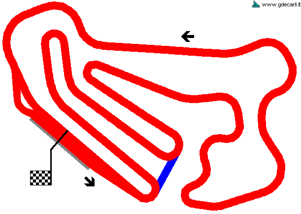
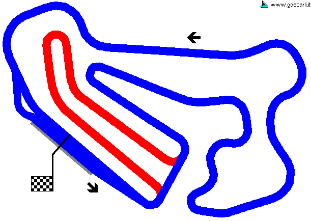
| Years | 1972 | ||||
| Direction |  Anticlockwise Anticlockwise | ||||
 Proposal Proposal |
YES
| ||||
| Proposal not developed | YES | ||||
| Car Circuit | |||||
| Motorbike circuit | |||||
| Type | Permanent | ||||
| Inauguration | |||||
| Closing | |||||
| Last update of this page | November 27th 2005 | ||||
| Info last update | November 1972 | ||||
| Designer | |||||
| Distinctive points | |||||
| length | 3000 m | 9843 ft | 1.864 mi | (1) | |
Calcarelli
| Updates | |||||||
| Date | Track layout | Years | Description by | Map by | Thanks to | Note | |
| November 27th 2005 | Guido de Carli | Guido de Carli | New | Description with map | |||
| Not all eventual updates issued in last years are already visible in this list | |||||||
Webmaster:
Guido de Carli

(Italiano - English - Español)
HOME PAGE